The following soft cover publications are available by post from:
Mrs M.C. Hurst
6 Poplar Avenue
East Leake
Loughborough
Leics. LE12 6QB
Or from their bookstall, at meetings on the third Wednesday of the month from September to April, held in the St. Mary’s Hall opposite St. Marys’ Church East Leake at 7-30pm
Calculated and Compiled by Brian Davis from a 19th Century sampler
in Montacute House.
This is 2 A4 sheets, one which explains the method and the other which gives all the letters and numbers.
Both sheets need to be placed side by side then any day of a given date in the past or future can worked out.
£1.75 including UK P&P
£2.30 including p&p to Europe
£3.10 including p&p to rest of World
Payment to be made to ‘ East Leake & District Local History Society’ by cheque or postal order for purchases from the UK.
Payment by Paypal is preferred for purchases from abroad.
- By Mollie Jacques, based on research done by R.Owen Wood
- Maps Illustrations & photographs by Keith Wood
- Format- A4 27 Pages
- Published by East Leake Parish Council-2009
- ISBN 0 953 103 0 2
CONTENTS;-
- Foreward- Acknowledgements- Preface..
- Introduction..
- The Town Lands..
- Tenancies..
- Relationship between the Trust and the Parish Council..
- The Town Lands Trust Indenture 1808..
- Finance and Accounts..
- Commentary on examples from the minute books for July 1919 to December 1966..
- Events in the life of the East Leake Town Lands Trust since about 1950…
- Appendix 1: Transcript of the 1808 indenture..
- Appendix 2: Trustees identified in the 1808 indenture..
- Appendix 3: CLA tenancy agreement..
- Sources..
- Front Cover- Photograph of Town Land Trust Field.
- Back Cover- Photograph of the fields bordering Gotham Lane and Stocking Lane owned by Town Lands Trust…….
- Plan of the Town Lands at the time of the award 1799
- Plan of the Town Lands in 1887
- Plan of the Town Lands in 1922 showing the affect of the Manchester, Sheffield and Lincoln Railway
- The Town Lands Trust Indenture 1808- over the centre fold pages Page1 showing the title, Page 2, which is attached in front of page 1 and is secured by the seals of those who signed the documents and by threads.
- Plan of the Town Lands in 1950
- Plan of the Town Lands fields in 1969 showing recent housing developments in the area.
- Photograph of Seals and signatures of Witnesses- Angrave x3, Woodroffe x2 , Marcer x2, Wootton x2 , Burrows
- Photograph of the beginning of the 1808 indenture
£6.400p including. UK p&p
£ 7.50p including. p&p to Europe.
£ 9.00p including. p&p to rest of World.
Payment to be made to ‘East Leake and District Local History Society’ by Cheque or Postal order for orders from the UK.
Payment by Paypal is preferred for orders from abroad.
A History Of East Leake by Owen Wood Published for the East Leake Parish Council Centenary 1895-1995
Published 1999
Format: – Quarto? (larger than A5 and smaller than A4) 78 Pages
ISBN: – 0 9535103 0 1
- Early Times
- A Medieval Agricultural Community
- Thirteenth to Eighteenth Centuries
- Farming and Enclosure
- Industries of East Leake
- Modern Times
- The Iron age estate in East Leake and neighboring villages.
- Representation of the Saxon Church at Esterleke showing how the present church might lave looked in the early days. Drawn by David Clarke
- Family tree of the Leakes of Leake and Sutton Scarsdale
- Family tree of Stauntons, Shirleys and Ferrers
- Part of the first lines of the deed establishing the Town Lands Trust
- Signatures of the original trustees of the Town Lands Trust deed
- The Bley Endowed Free School
- The inscription on the side of the tomb of John Bley
- Fifteenth century poppy seat and two seventeenth century seats in the church
- Map showing the fields after enclosure( some details omitted)
- Computor generated map showing the open fields of East Leake with Enclosure Map superimposed
- 24 assorted Black and White and coloured photographs over six pages
- Photographs of Parish Councillors 1995 & 1999
- The locations of the Framework Knitting Industry in East Leake
- A page from Mark W. Mills catalogue showing drawings by George Godber
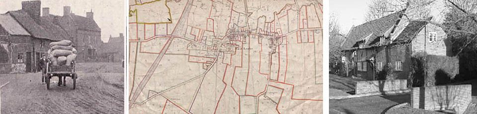
- Two old pictures of the same stretch of Main Street
- Map of East Leake 1884
- Street Plan of East Leake 1999
£6.70 including uk p&p
£8.50 including p&p to Europe
£10.60 including p&p to rest of world
Payment to be made to ‘ East Leake & District Local History Society’ by cheque or postal order for purchases from the UK.
Payment by Paypal is preferred for purchases from abroad.